


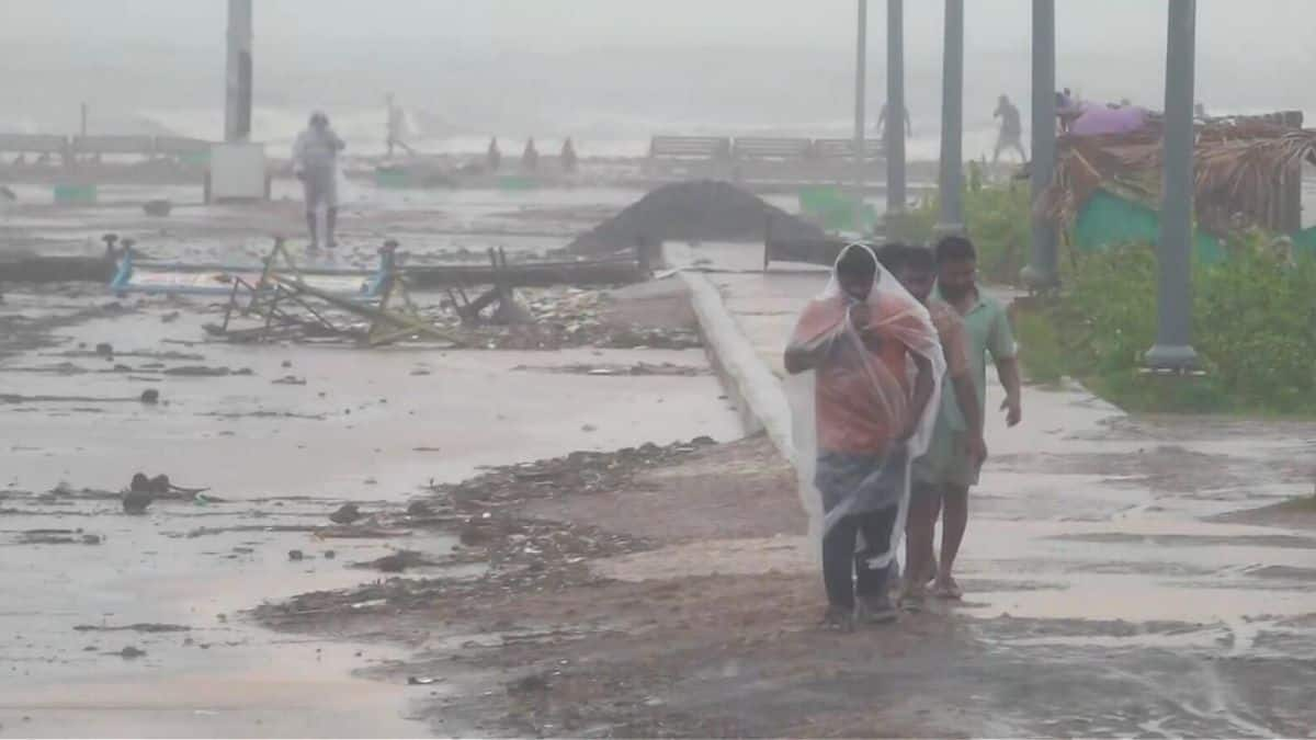
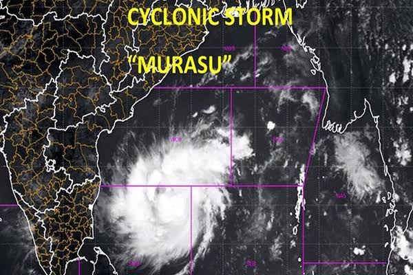
AMARAVATI, November 2, 2026 — Cyclone Murasu intensified into a severe cyclonic storm over the west-central Bay of Bengal, the India Meteorological Department (IMD) said in its 5 am bulletin on Monday, warning that winds could reach 100–110 km/h with gusts up to 120 km/h when the system crosses the south Andhra Pradesh coast late on November 2 or in the early hours of November 3.
The forecast crossing zone runs from Nellore to Narsapur, close to Ongole. The IMD also warned of a storm surge of about 1.0–1.5 metres above the astronomical tide that could inundate low-lying parts of south coastal Andhra Pradesh, with the highest surge expected in Bapatla, Krishna and Prakasam districts. The landfall window remains a forecast, not confirmation that the cyclone has reached the coast.
National Bulletin No. 11, issued at 5 am IST on November 2, said Murasu had moved nearly north-westwards at about 20 km/h during the preceding six hours. At 2.30 am, the storm’s centre was estimated near 13.6° north latitude and 82.5° east longitude, roughly 260 km east-north-east of Chennai, 290 km east-south-east of Nellore and 330 km south-east of Ongole.
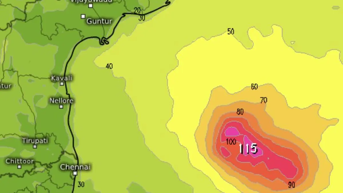
The bulletin’s forecast placed the system near 13.9°N and 81.9°E at 5.30 am, with sustained winds of 95–105 km/h and gusts up to 115 km/h. The IMD expected the storm to strengthen further as it moved towards the coast, with winds of 100–110 km/h and gusts up to 120 km/h around the projected crossing.
Those wind speeds describe the storm and its forecast impact zone; they do not mean every town or district will experience the same conditions. The exact track, the distance from the centre and local terrain can produce sharp differences in wind, rainfall and flooding risk. Residents should follow district-specific instructions rather than interpret a regional forecast as a precise local prediction.
Also read: Cyclone Murasu: IMD Issues Red Warning for Andhra Coast, Forecasts 120 km/h Gusts
The IMD forecast Murasu would continue moving north-west and cross the south Andhra coast between 11.30 pm on Monday and 4 am on Tuesday, November 3. It identified the wider stretch between Nellore and Narsapur, close to Ongole, as the likely crossing area. The timing and point of landfall may change as the storm approaches shallower coastal waters and forecasters receive new observations.
The bulletin scheduled its next update for 8.30 am IST on Monday. Until then, the 5 am bulletin is the latest national forecast used for this report. A later bulletin or district-level warning could revise the projected track, timing, wind intensity or areas at risk.
Beyond wind and rain, the IMD warned that a surge of around 1.0–1.5 metres above the normal astronomical tide could push seawater into low-lying coastal areas during landfall. The bulletin identified Bapatla and parts of Krishna and Prakasam districts as locations where the peak surge could be highest.
A storm surge is an abnormal rise in sea level driven mainly by a cyclone’s winds and low atmospheric pressure. Its effects can be amplified when it coincides with the regular tide. Water can move inland through low-lying terrain, drainage channels and river mouths, potentially flooding settlements, roads and agricultural land even away from the point where the storm’s centre crosses the coast.
The IMD warned that the west-central Bay of Bengal would experience very high sea conditions through Tuesday morning, with waves estimated at 9–14 metres in the affected offshore area. It advised fishermen not to venture into the west-central Bay until the afternoon of November 4 and warned that movement by small boats and ships would be unsafe in the affected waters.
Coastal Andhra Pradesh is forecast to receive heavy to very heavy rainfall at a few places, with extremely heavy rain possible at isolated locations on November 2 and 3. The IMD also forecast heavy to very heavy rain at isolated places in Rayalaseema on both days, while south Odisha is expected to see heavier rainfall as the system moves closer to land and then weakens.
North Tamil Nadu and Puducherry are forecast to receive heavy to very heavy rain at isolated places, while Telangana could see heavy rainfall through November 4, including isolated extremely heavy rain on November 3. The bulletin also warned of heavy to very heavy rain over parts of south Chhattisgarh on November 3 and 4. These are regional forecasts; local rainfall totals will depend on the storm’s eventual track and rain bands.
Rainfall away from the immediate coastline can still cause disruption. Waterlogging, swollen streams, river flooding and blocked roads may cut off communities or complicate emergency access. Low-lying urban areas can flood quickly when intense rain falls over already saturated ground or when drainage systems are overwhelmed.
The IMD’s impact assessment warns of major damage to thatched huts and other vulnerable houses, the possibility of roofs and unsecured metal sheets being blown away, and the risk of trees, branches, hoardings and power or communication poles falling. Standing crops, banana and papaya plants, coconut palms, orchards and coastal agriculture may also be damaged. Roads and rail operations could be disrupted by flooding, fallen trees and damage to electrical or signalling infrastructure.
People in low-lying coastal settlements should follow evacuation or relocation directions from local authorities and move away from weak structures if instructed. Residents should secure loose outdoor objects, avoid exposed coastal stretches and flooded roads, and keep away from fallen power lines. Fishermen and small-boat operators should observe the suspension of fishing and marine activity in the warned areas.
For residents, the most useful information is the latest district-specific advisory, not an old screenshot or a forwarded message. The Andhra Pradesh State Disaster Management Authority’s tracker and the NDMA’s SACHET alert system can show whether alerts have been extended, replaced or cancelled. Emergency instructions from district administrations take priority over general summaries.
Authorities had already stepped up preparedness before the latest bulletin. Earlier reporting by PTI carried by The Economic Times said Odisha had placed southern areas on high alert and ordered precautionary evacuations in vulnerable low-lying and hilly locations. The new severe-cyclone classification raises the importance of checking whether local evacuation, transport and shelter instructions have changed.
Also read: IMD Issues Extreme Cyclone Alert Across 22 Andhra Districts
The next key marker is the IMD’s scheduled 8.30 am bulletin on Monday, followed by district-level decisions on evacuation, school or transport operations and access to coastal areas. Forecasters will continue to refine the cyclone’s position and intensity, while authorities will need to assess local flooding and damage risks as rain and winds increase. The projected landfall window is late Monday night into early Tuesday, but residents should not wait for the storm to reach land before following official safety instructions.



Comments (0)
Be the first to comment. Comments are published after moderation.