


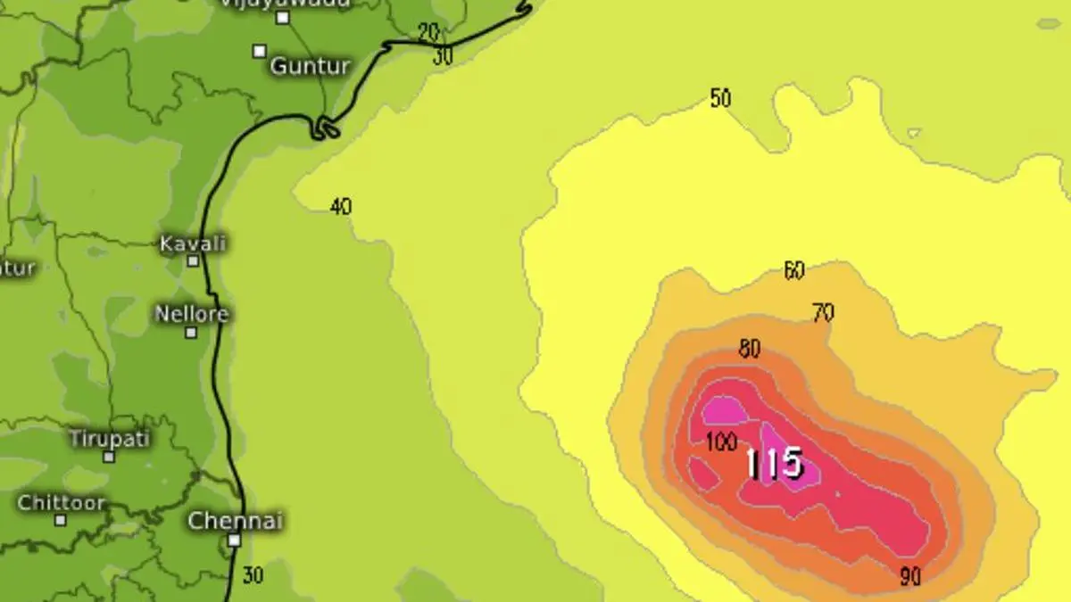
The India Meteorological Department (IMD) has widened its storm-surge forecast for Cyclone Murasu in a national bulletin issued at 02:00 IST on Monday, 2 November. The agency now warns that a surge of about 1.0–1.5 metres above the astronomical tide could inundate low-lying parts of south coastal Andhra Pradesh as the system approaches the coast.
The revised range extends the upper end of the 1.0–1.2-metre estimate in the preceding 21:00 IST bulletin on Sunday to 1.5 metres. The change is a forecast revision, not confirmation that coastal flooding has already occurred. The IMD’s National Bulletin No. 10 also says Murasu is likely to intensify into a severe cyclonic storm over the west-central Bay of Bengal within the following three hours.
At 23:30 IST on 1 November, the cyclone’s centre was near 13.3°N and 83.0°E, about 300 km east of Chennai and 350 km east-southeast of Nellore. It had moved west-northwestwards at about 23 km/h during the preceding six hours, the bulletin said.
Also read: Cyclone Murasu: IMD Issues Red Warning for Andhra Coast, Forecasts 120 km/h Gusts
The IMD expects Murasu to move northwestwards and cross the south Andhra Pradesh coast as a severe cyclonic storm between Nellore and Narsapur, close to Ongole. The forecast window runs from about 23:30 IST on 2 November to 04:00 IST on 3 November.
The agency forecasts sustained winds of 100–110 km/h near landfall, with gusts reaching 120 km/h. Its forecast table gives 95–105 km/h winds, gusting to 115 km/h, for 05:30 IST on Monday, followed by 100–110 km/h, gusting to 120 km/h, later in the day. At the time Bulletin No. 10 was issued, the IMD still classified Murasu as a cyclonic storm; the upgrade to severe was forecast, not yet confirmed in that bulletin.
The likely crossing stretch is not a precise point prediction. The cyclone’s centre, strongest winds and heaviest rain may affect different locations, so district-level warnings remain important even if the broad track does not change. The New Indian Express also reported the IMD’s forecast of a severe storm crossing the south Andhra coast between Nellore and Narsapur.
For coastal Andhra Pradesh, the IMD forecasts heavy to very heavy rainfall at a few places and extremely heavy rainfall at isolated places on 2 and 3 November. Rayalaseema is likely to receive heavy to very heavy rain at isolated places on both days. The bulletin also warns of heavy rain in parts of Tamil Nadu, south Odisha, Telangana and south Chhattisgarh, with isolated very heavy or extremely heavy falls possible in some areas.
Along and off the Andhra coast, squally winds of 40–50 km/h, gusting to 60 km/h, were prevailing at the time of the bulletin. The IMD expects them to strengthen to 65–75 km/h, gusting to 85 km/h, by Monday noon, then to 80–90 km/h, gusting to 100 km/h, from the evening. The strongest coastal winds are forecast from around midnight into the early hours of 3 November.
Sea conditions along and off Andhra Pradesh are expected to become high to very high from the morning of 2 November until around noon on 3 November. The IMD has advised fishermen not to venture into the affected waters along the Andhra coast from the morning of 2 November until the afternoon of 4 November. Restrictions also apply to parts of the Bay of Bengal and the north Tamil Nadu–Puducherry coast.
Also read: Cyclone Arnab Flooding Cuts Off Odisha Villages, Disrupts Rail
The 1.0–1.5-metre storm-surge forecast applies to low-lying areas of south coastal Andhra Pradesh. The IMD identifies Bapatla as a location where the peak surge is expected, along with parts of Krishna and Prakasam districts. A storm surge is a temporary rise in sea level above the astronomical tide; the forecast figure should not be read as a prediction that every street or settlement will be covered by water to that depth.
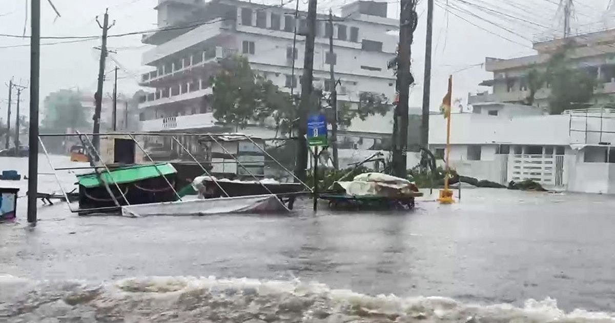
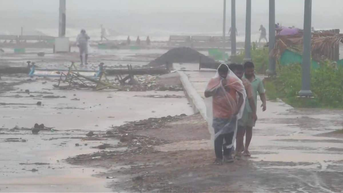
The IMD’s impact guidance warns of possible damage to thatched and other vulnerable houses, roofs and unsecured metal sheets, as well as fallen trees and damage to power or communication poles. Heavy rain could cause waterlogging, local flooding and disruption to roads, railways and railway signalling. These are risks identified in the bulletin, not confirmed reports of damage caused by Murasu.
Andhra Pradesh has also prepared medical and shelter support. The Times of India reported at 23:09 IST on 1 November that the state health department had deployed 1,688 medical teams and readied 116 relief camps. It reported that 13,165 emergency beds and 733 ambulances were on standby, and that 493 of 6,870 pregnant women whose expected delivery dates fall between 1 and 10 November had been shifted to nearby hospitals.
Also read: Andhra Puts Cyclone Arnab Damage at ₹4,600 Crore; Central Team Due Friday
Residents in low-lying coastal settlements should follow evacuation and shelter instructions issued by district administrations. The IMD advises coastal hutment residents in affected areas to move to safer places and people in vulnerable structures to avoid remaining indoors in unsafe buildings. Fishermen should follow the suspension advice and harbour or fisheries department instructions.
People should avoid beaches, exposed coastal areas and flooded roads, and should not approach fallen power lines. Travellers should check current road and railway advisories before setting out. Port, shipping and offshore operators are advised to monitor subsequent weather warnings and review operational preparedness.
Bulletin No. 10 said the next national update was due at 05:30 IST on 2 November. That bulletin is expected to provide a further assessment of Murasu’s position, intensity and track. Until then, the 02:00 IST forecast remains the latest official national bulletin available for this report.
Frequently asked questions
When is Cyclone Murasu expected to make landfall?
The IMD forecasts that Murasu will cross the south Andhra Pradesh coast between Nellore and Narsapur, close to Ongole, from about 23:30 IST on 2 November to 04:00 IST on 3 November 2026.
How high could the storm surge from Cyclone Murasu reach?
The IMD’s 02:00 IST bulletin on 2 November forecasts a surge of about 1.0–1.5 metres above the astronomical tide in low-lying parts of south coastal Andhra Pradesh. This is a forecast range, not a guaranteed water depth at every location.
What wind speeds does the IMD forecast near landfall?
The IMD forecasts sustained winds of 100–110 km/h, with gusts reaching 120 km/h, as Murasu crosses the south Andhra Pradesh coast.
Sources: India Meteorological Department


Comments (0)
Be the first to comment. Comments are published after moderation.