


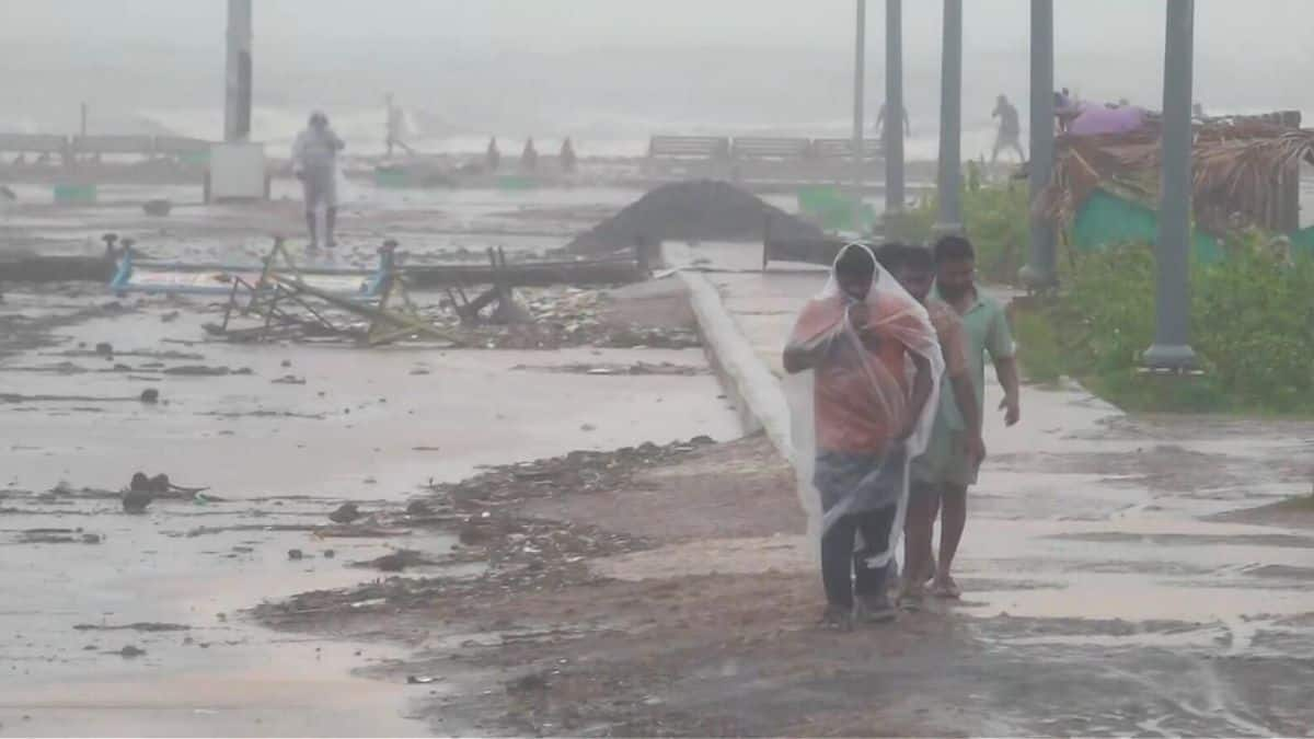
AMARAVATI, November 1, 2026 — The India Meteorological Department (IMD) has issued a red cyclone-warning message for Andhra Pradesh and adjoining north Tamil Nadu as Cyclone Murasu moves towards the south Andhra coast, with landfall still forecast between Nellore and Narsapur from late Monday night into the early hours of Tuesday. In its latest national bulletin, issued at 9 p.m. IST on Sunday, the weather agency said the storm was expected to strengthen into a severe cyclonic storm before crossing the coast with sustained winds of 100–110 km/h and gusts reaching 120 km/h.
The bulletin is a material update to the earlier outlook: Murasu has formed, the warning has advanced to a red message, and the IMD has narrowed its storm-surge forecast to about 1.0–1.2 metres above the astronomical tide in low-lying parts of south coastal Andhra Pradesh. The department continues to warn of heavy to very heavy rainfall, with extremely heavy rain possible at isolated locations, while sea conditions are expected to become high to very high near the coast.
Also read: IMD Forecasts Severe Cyclonic Storm Crossing South Andhra Coast on November 3
The forecast describes what may happen over the coming two days, not a confirmed landfall or a report of damage already caused by Murasu. The storm’s track, intensity and local impacts can change as new observations arrive. Residents should follow the latest IMD bulletins and instructions from district authorities rather than rely on older forecasts or unverified social-media posts.
According to National Bulletin No. 8, Murasu was centred at 5.30 p.m. IST on Sunday near latitude 12.7°N and longitude 84.1°E over the southwest and adjoining west-central Bay of Bengal. The centre was about 420 km east-southeast of Chennai, 490 km east-southeast of Nellore, 500 km southeast of Machilipatnam and 530 km southeast of Ongole. The system had moved west-northwestwards at about 25 km/h in the preceding six hours.
The IMD expects the storm to intensify further into a severe cyclonic storm over the west-central Bay of Bengal by the early hours of November 2. It is then forecast to turn northwest and cross the south Andhra Pradesh coast between Nellore and Narsapur, close to Ongole, between 11.30 p.m. on November 2 and 4 a.m. on November 3.
The forecast table gives a gradual rise in wind strength as the system approaches land. At 5.30 p.m. on Sunday, the storm’s maximum sustained winds were estimated at 80–90 km/h, gusting to 100 km/h. By late Sunday night, the bulletin projected 90–100 km/h winds with gusts to 110 km/h. By late morning on Monday, it forecast 100–110 km/h, with gusts to 120 km/h.
The projected crossing corridor is not a pinpoint prediction. The centre of a cyclone can shift, and its strongest winds and heaviest rain do not necessarily occur directly under the centre. Local conditions may differ sharply between coastal villages, inland areas and individual districts, which is why the IMD’s district-level warnings and local administration orders remain important even when the broad track stays unchanged.
One notable change between the IMD’s 5.30 p.m. and 9 p.m. bulletins is the estimate for storm surge. The earlier bulletin put the surge at about 1.0–1.5 metres above the astronomical tide; the latest bulletin gives a range of about 1.0–1.2 metres during landfall. Both bulletins identify Bapatla, Guntur, Krishna and Prakasam among the districts where the peak surge is expected to be highest.
A storm surge is a temporary rise in sea level pushed towards the coast by a storm. It is measured above the tide that would otherwise have occurred; it is not a promise that every street will be covered by water to that depth. The effect on the ground depends on elevation, coastline shape, tides, drainage, waves and how far seawater can move inland. Even a forecast surge that is lower than an earlier estimate can threaten low-lying coastal settlements when combined with rough seas and heavy rainfall.
The IMD’s warning is therefore relevant beyond the expected landfall point. People living in low-lying coastal areas, particularly in places vulnerable to tidal flooding, should pay attention to any evacuation or shelter instructions from district officials. The bulletin also warns of unsafe marine conditions and possible disruption to roads, railways, power lines and communications.
The IMD expects rainfall to intensify across coastal Andhra Pradesh on November 2 and 3. The latest national bulletin forecasts heavy to very heavy rainfall at a few places and extremely heavy rainfall at isolated places on both days, followed by heavy rain at isolated places on November 4. The wording matters: an “isolated” extreme-rainfall forecast does not mean every district will receive the same amount, but it signals that localised downpours could be intense.
Rayalaseema is forecast to receive heavy to very heavy rainfall at isolated places on November 2 and 3. In Tamil Nadu, heavy to very heavy rain is expected at isolated places on November 2, with heavy to very heavy rainfall also possible at isolated places the following day. South Odisha is forecast to see heavy rain at isolated places on November 2, increasing to heavy to very heavy rain at isolated places on November 3 and 4.
Telangana is also within the wider weather impact area. The IMD forecasts heavy rainfall at isolated places from November 2 to 4, with extremely heavy rainfall possible at isolated places on November 3. South Chhattisgarh could receive heavy rain on November 2 and heavy to very heavy rain at isolated places on November 3 and 4.
The Times of India, in a report updated at 9.43 p.m. IST on Sunday, said red rainfall alerts had been issued for Krishna, Guntur, Bapatla, Prakasam and Nellore for Monday. It reported red alerts for Alluri Sitharama Raju and Eluru for Tuesday, with orange alerts covering several other districts. Alert colours and district lists can be updated as the IMD issues new guidance, so readers should check the latest district warning rather than treat a media summary as a substitute for the official bulletin.
Along and off the Andhra Pradesh coast, squally winds of 40–50 km/h, gusting to 60 km/h, were forecast to begin on Sunday evening. The IMD expects these to strengthen to 65–75 km/h, gusting to 85 km/h, by Monday noon, then to 80–90 km/h, gusting to 100 km/h, from Monday evening. The bulletin projects the strongest coastal winds—100–110 km/h with gusts up to 120 km/h—from around midnight Monday into Tuesday forenoon.
Sea conditions are expected to deteriorate in parallel. The IMD says conditions along and off the Andhra coast are likely to become high to very high from Monday morning through Tuesday noon before gradually improving. Such conditions make small-boat movement dangerous and can complicate port, shipping, offshore and marine-tourism operations. The department has advised fishermen not to venture into the west-central Bay of Bengal until the afternoon of November 4 and not to go out along and off the Andhra coast from Monday morning until Wednesday afternoon.
Also read: Bay of Bengal Depression May Strengthen Near Andhra Coast
Those restrictions are operational warnings, not a general statement that all ports or all transport services have already been shut. Any closures, suspensions or route changes should be confirmed through the relevant port, transport operator or district administration. People should not go to beaches or exposed coastal areas to watch the storm, and boats should not be taken out against official advice.
The bulletin’s impact guidance identifies several hazards that authorities and residents should prepare for. Strong winds can damage thatched huts and other vulnerable structures, lift unsecured metal sheets, break branches and uproot trees. Power and communications poles may be affected, while standing crops, plantations, orchards, banana and papaya trees and other horticultural crops could suffer damage.
Heavy rain can create a different chain of problems. Waterlogging may disrupt urban traffic, flood low-lying roads and cut escape routes. The IMD also lists possible disruption to rail services, overhead power lines and signalling systems, alongside riverine, urban and coastal flooding. These are forecast risks rather than confirmed damage reports, and their severity will depend on the storm’s final track, rainfall distribution and local preparedness.
Farmers, fishing communities, port operators and local utilities have different exposure to these hazards. Coastal farmers may be concerned about crop lodging, salt-water intrusion and damage to plantations; fishing households face the loss of working days when boats must remain ashore. Transport agencies may need to monitor waterlogged stretches and vulnerable infrastructure, while electricity crews may need to prepare for fallen branches or damaged distribution lines. The bulletin does not confirm that any of these impacts has already occurred because of Murasu.
The IMD’s action guidance calls for fishing operations to be suspended in affected waters, coastal hutment residents to be moved to safer places and people in affected areas to remain indoors. It advises against staying in vulnerable structures and urges authorities to regulate road and rail traffic where necessary. Residents should follow evacuation notices and shelter directions from local officials promptly, particularly if they live in low-lying coastal settlements or areas that flood repeatedly.
Households can use the remaining time to charge phones, keep essential medicines and important documents accessible, store drinking water and follow local instructions about safe shelter. Loose objects around homes should be secured if it is safe to do so. Do not approach downed power lines, enter floodwater or attempt to cross a flooded road. These are precautionary steps; they do not replace official evacuation orders or district-specific advice.
Fishermen should follow the IMD’s area-specific marine warning and instructions from fisheries and harbour authorities. Vessel owners and operators should check official notices before making decisions about sailing, port activity or marine tourism. Travellers should confirm services with transport operators and monitor local traffic advisories rather than assume that every road or rail route will remain open.
The next key checkpoint is the IMD’s subsequent national bulletin, listed in Bulletin No. 8 as due at 11.30 p.m. IST on November 1. That update may refine the storm’s position, movement, intensity, landfall window, rainfall distribution or surge forecast. Any change should be read against the previous bulletin so that a revised forecast is not mistaken for an event that has already happened.
For now, the broad scenario remains a severe cyclonic storm crossing the south Andhra coast between Nellore and Narsapur late Monday night or early Tuesday, with damaging winds, heavy rainfall and a risk of coastal inundation. The most useful information for residents is the latest district warning and any local order on evacuation, shelter, fishing, travel or public services. Forecasts will become more precise as the storm approaches, but decisions about safety should not wait for the final hours if authorities advise people to move.


Comments (0)
Be the first to comment. Comments are published after moderation.