



Odisha has begun another round of evacuations from low-lying and landslide-prone parts of its southern districts as Cyclone Murasu approaches the Andhra Pradesh coast. The India Meteorological Department (IMD) forecasts that the storm will intensify into a severe cyclonic storm before crossing the south Andhra coast between Nellore and Narsapur late on November 2 or in the early hours of November 3.
The IMD’s National Bulletin No. 6, issued at 2:30 p.m. IST on November 1, gives a landfall window from 11:30 p.m. on November 2 to 4 a.m. on November 3. It forecasts sustained winds of 100–110 kmph, with gusts reaching 120 kmph. The agency’s forecast may change as the system moves closer to the coast, so residents should continue to follow fresh bulletins and district instructions.
The latest reported development is Odisha’s renewed evacuation operation. The Times of India reported at 9:13 p.m. IST on November 1 that state authorities had started moving people from vulnerable low-lying and landslide-prone locations, with the administration aiming to complete the exercise by Monday evening. The report cited Special Relief Commissioner Rajesh Prabhakar Patil and identified saturated soil left by Cyclone Arnab as a continuing landslide concern.
Odisha has placed Ganjam, Gajapati, Kandhamal, Koraput, Malkangiri and Rayagada on high alert. Officials are focusing on settlements in low-lying areas and locations exposed to landslides, particularly where the ground remains saturated after heavy rain associated with Cyclone Arnab, which affected the region in the final week of October.
Patil told The Times of India that at least 150 vulnerable locations had been identified in Gajapati district. The state is shifting residents from risk areas to safer places and has directed district administrations to keep evacuation arrangements, shelters, drinking water and emergency medical services ready. The report did not give a consolidated number of people moved in this latest round, so the scale of the evacuation should not be inferred from the number of locations identified.
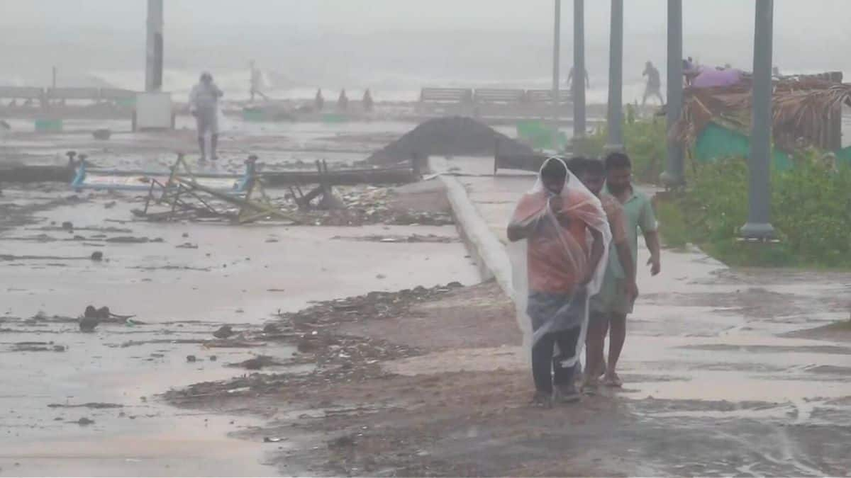
The concern is not limited to the cyclone’s forecast wind field. Rain falling on already saturated slopes can increase the risk of landslides, while fresh downpours can worsen local flooding and disrupt access to villages. Odisha officials said disaster-response teams were being kept on standby and that vulnerable areas would be monitored.
Also read: Cyclone Arnab Flooding Cuts Off Odisha Villages, Disrupts Rail
The IMD said the deep depression over the southwest and adjoining west-central Bay of Bengal intensified into Cyclonic Storm Murasu at 11:30 a.m. IST on November 1. The system was then centred about 560 km east-southeast of Chennai and 660 km south-southeast of Visakhapatnam, according to the agency’s bulletin.
The forecast path takes Murasu northwestwards towards the south Andhra Pradesh coast. The IMD expects it to strengthen into a severe cyclonic storm before crossing between Nellore and Narsapur during the stated overnight window. The forecast wind range is 100–110 kmph, with gusts up to 120 kmph.
These are forecast conditions, not a report that landfall has already occurred. The exact track, timing and local impacts can change with new observations. The Andhra Pradesh State Disaster Management Authority’s cyclone tracker reproduces the latest IMD bulletin information and separately labels its model guidance; the model estimates should not be treated as an official IMD warning.
Also read: Andhra Puts Cyclone Arnab Damage at ₹4,600 Crore; Central Team Due Friday
Manorama Mohanty, director of the IMD’s meteorological centre in Bhubaneswar, told The Times of India that Murasu is likely to bring heavy to very heavy rainfall to Ganjam, Gajapati, Rayagada, Koraput and Malkangiri. Rainfall could continue for several days before gradually easing. Winds of 50–60 kmph, gusting up to 70 kmph, are also possible in parts of southern and coastal Odisha during the cyclone’s passage.
Sea conditions along the Odisha coast are expected to become rough to very rough. Fishermen have been advised not to venture into the sea, while district administrations have been told to remain prepared for evacuation and emergency response. The PTI report carried by The Week on November 1 also reported the cyclone’s formation and the Odisha government’s high-alert preparations.
Also read: Cyclone Arnab Landfall Process Begins; IMD Warns of Godavari Surge
The next key updates are the IMD’s track and intensity bulletins, district-level rainfall and wind warnings, and evacuation directions from local administrations. People in areas identified as vulnerable should follow official instructions on moving to shelters. Fishermen should observe the current marine warnings and restrictions rather than rely on older forecasts.
For Odisha, the previous cyclone’s rainfall makes landslide preparedness an important part of the response. For Andhra Pradesh, the forecast landfall window and wind range mean coastal districts will need to maintain readiness for strong winds, heavy rain and possible disruption. Neither the forecast nor the start of evacuation operations establishes the eventual extent of damage; that will depend on the storm’s final track, intensity and local conditions.
Frequently asked questions
When is Cyclone Murasu expected to cross the Andhra Pradesh coast?
The IMD’s National Bulletin No. 6, issued at 2:30 p.m. IST on November 1, forecasts a crossing between Nellore and Narsapur from 11:30 p.m. on November 2 to 4 a.m. on November 3, 2026.
How strong could Cyclone Murasu become?
The IMD forecasts that Murasu is likely to intensify into a severe cyclonic storm, with sustained winds of 100–110 kmph and gusts reaching 120 kmph near the south Andhra Pradesh coast.
Which Odisha districts have been placed on high alert?
The latest report identifies Ganjam, Gajapati, Kandhamal, Koraput, Malkangiri and Rayagada. Authorities have begun evacuations from vulnerable low-lying and landslide-prone locations.
How many vulnerable locations have been identified in Gajapati?
Odisha Special Relief Commissioner Rajesh Prabhakar Patil told The Times of India that at least 150 vulnerable locations had been identified in Gajapati district. The report did not provide a consolidated count of residents moved in the latest evacuation round.




Comments (0)
Be the first to comment. Comments are published after moderation.