


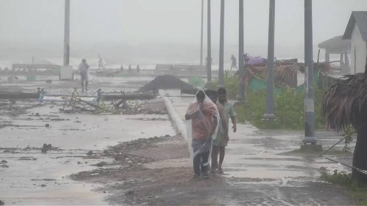
NEW DELHI, November 1, 2026: The India Meteorological Department (IMD) has forecast that a depression over the southeast Bay of Bengal could intensify into a severe cyclonic storm before crossing the south Andhra Pradesh coast between Nellore and Narsapur by the morning of November 3. In National Bulletin No. 3, issued at 2:50 a.m. IST on Sunday, the department forecast sustained winds of 100–110 kmph, with gusts up to 120 kmph, for the projected crossing. The system remains a depression in the latest bulletin; it has not yet reached cyclonic-storm intensity.
The IMD said the depression moved west-northwestwards at about 22 kmph during the six hours before 11:30 p.m. IST on October 31. At that time, its center was near 10.9°N and 87.5°E, about 830 km east-southeast of Chennai, 880 km south-southeast of Visakhapatnam, and 900 km southeast of Machilipatnam. The forecast track and intensity remain subject to change as new observations become available.
The department expects the system to strengthen into a deep depression over the southwest and adjoining southeast Bay of Bengal by noon on November 1. It is forecast to become a cyclonic storm by midnight on Sunday and a severe cyclonic storm over the west-central Bay of Bengal on November 2. The IMD expects it to approach waters near the south Andhra Pradesh coast in the early hours of November 3.
The bulletin’s narrative forecast gives a crossing corridor between Nellore and Narsapur and a wind range of 100–110 kmph, gusting to 120 kmph. Its forecast table projects the system reaching severe-cyclone intensity over the west-central Bay on November 2 night, followed by a gradual weakening over the following period. The timing, category, and exact crossing point may be revised in later bulletins; the forecast should not be treated as confirmation of a fixed landfall.
The latest forecast is a material update to the earlier outlook. A previous Fortune Post report described an earlier estimate of sustained winds of 80–90 kmph, with gusts up to 100 kmph. The new IMD bulletin now identifies a more specific south Andhra crossing corridor and gives a higher wind range in its landfall narrative.
Also read: Bay of Bengal Depression May Strengthen Near Andhra Coast
Rainfall warnings cover several states. For coastal Andhra Pradesh, the IMD forecasts heavy rain at isolated places on November 1, followed by heavy to very heavy rain at a few places and extremely heavy rain at isolated places on November 2. Heavy to very heavy rain is likely at isolated places on November 3, with heavy rain possible on November 4. The department has also forecast heavy to very heavy rain at isolated places over Rayalaseema on November 2 and 3.
In south Odisha, heavy rain is forecast at isolated places on November 2, with heavy to very heavy rain possible at isolated places on November 3 and 4. Tamil Nadu may receive heavy rain at isolated places on November 2 and 3, while Telangana is forecast to see heavy rain at isolated places on those two days. These are area-specific forecasts, not a prediction that every district will receive the same rainfall.
The IMD’s Met Centre Amaravati warning page lists heavy rain, thunderstorms, lightning, and strong surface winds for coastal Andhra Pradesh on November 1. It raises the rainfall warning to extremely heavy rain for November 2 and very heavy rain for November 3. Rayalaseema is also under warnings for very heavy rain on November 2 and 3. Residents should check the district-level warning for their location because the forecast can vary within a state.
Also read: IMD Warns of Heavy Rain Across Several States as New Bay of Bengal System Develops
Along and off the Andhra Pradesh coast, squally winds of 40–50 kmph, gusting to 60 kmph, are forecast to begin on the evening of November 1. The IMD expects them to strengthen to 65–75 kmph, gusting to 85 kmph, by the night of November 2, and to 80–90 kmph, gusting to 100 kmph, during the forenoon of November 3. These coastal wind forecasts are separate from the maximum wind range in the bulletin’s landfall narrative.
Sea conditions are expected to become rough to very rough along and off the Andhra coast from November 1 evening, deteriorating to high by November 2 evening and remaining so until the forenoon of November 3. The IMD has advised fishermen not to venture into the west-central Bay of Bengal from the morning of November 1 until the afternoon of November 4 and along and off the Andhra Pradesh coast from the morning of November 2 until the afternoon of November 4. Separate restrictions apply to parts of the southwest Bay, the north Tamil Nadu–Puducherry coast, and the south Odisha coast.
The department’s impact guidance identifies possible damage to thatched and kutcha houses, roofs, and detached metal sheets, along with damage to trees, standing crops, power and communication poles, and roads. It also warns of localized flooding and disruption to transport. The IMD advises suspension of fishing operations, moving residents of vulnerable coastal hutments to safer places, and following local instructions on road, rail, and marine activity. These are forecast risks, not reports that such damage has already occurred.
Also read: Andhra Pradesh Power Utilities Prepare for Bay of Bengal Storm
The new system is developing days after Cyclone Arnab crossed the Andhra Pradesh coast on October 28. Some communities and utilities are still dealing with the earlier storm’s damage. The fresh forecast makes continued monitoring important for coastal districts, farmers, fishing communities, transport operators, and electricity utilities, but the eventual impact will depend on the depression’s final track, intensity, rainfall distribution, and speed of movement.
Also read: Andhra Puts Cyclone Arnab Damage at ₹4,600 Crore; Central Team Due Friday
The IMD’s national bulletin says the next update is due at 8:30 a.m. IST on November 1. Until then, coastal residents and fishing communities should follow current district, port, and marine advisories rather than relying on older summaries. The Times of India reported on the broader November outlook in an update published at 1:40 a.m. IST on Sunday, while The Statesman reported on October 31 that South Odisha could also face squally weather and fishing restrictions. The latest IMD bulletins remain the primary source for the system’s current position and forecast.





Comments (0)
Be the first to comment. Comments are published after moderation.