


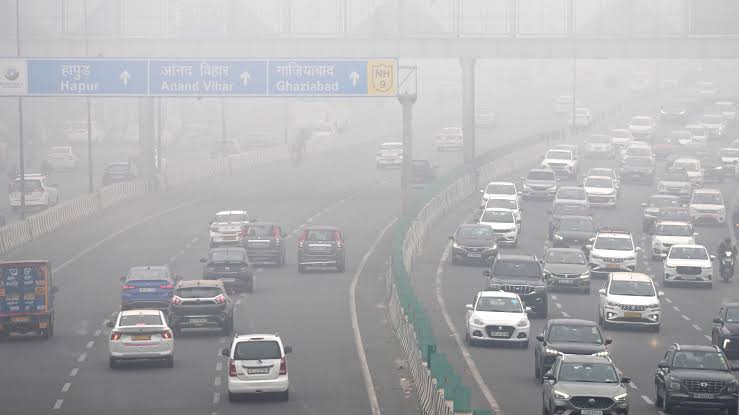
The India Meteorological Department operates a dedicated fog-warning portal that brings forecast information for national highways, railway stations and aviation into one map-based service. It is designed to help transport users and operators identify locations where reduced visibility may affect travel. The portal displays forecast layers for the first five days, but it is not a live flight tracker, train-running system or guarantee that a particular road will remain clear.
That distinction matters as the weather changes across northern and eastern India during the cooler months. A fog forecast is a warning about atmospheric conditions that may reduce visibility; it is not a report that every vehicle, train or aircraft in a district has been delayed. Travellers still need to check the latest information from the airline, railway operator, highway authority or local administration before setting out.
The IMD Fog Warning Portal combines map layers for railway stations, highways and aviation locations. Users can select a segment or location to view the available fog-warning information. The portal describes its warnings as being based on Day 1 to Day 5 forecast data. That makes it useful for planning ahead, particularly for transport operators coordinating early-morning movements, but the forecast horizon should not be mistaken for a minute-by-minute observation.
A forecast warning and an observed visibility reading are different kinds of information. A forecast estimates the likelihood and expected extent of fog over a period. An observation records conditions at a particular place and time. Fog can form in one low-lying stretch while a nearby area remains clearer, and conditions can change quickly after sunrise, a shift in wind or a change in humidity. A map therefore provides a planning signal, not a substitute for local judgement.
The portal is also separate from a pollution dashboard. Fog consists of tiny water droplets or ice crystals suspended close to the ground, while smog combines pollutants with atmospheric moisture and other particles. The two can occur together, but they are not interchangeable. A low-visibility warning does not tell a reader what the local air-quality index is, and an AQI reading does not establish whether a road is safe to drive on.
Also read: Delhi AQI Enters Very Poor Category as Morning Reading Reaches 310
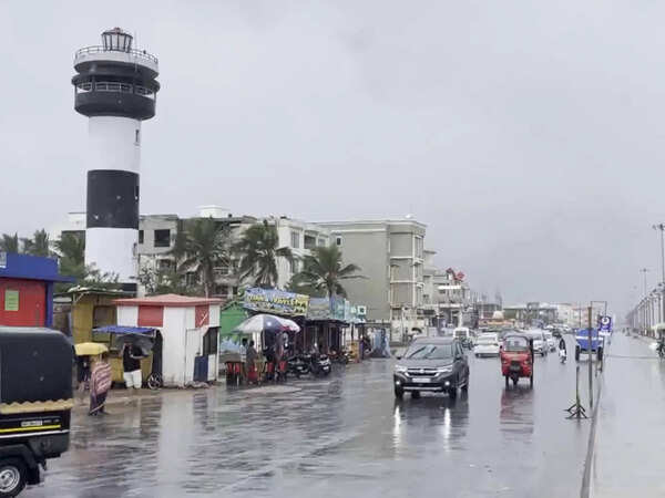
Also read: Chennai, Tiruvallur Schools Closed on November 2 as Cyclone Murasu Brings Heavy-Rain Risk
Start with the location that matters to your journey. A driver should look for the relevant highway stretch or nearby city rather than relying only on a state-wide forecast. A rail passenger should check the stations along the route, especially the origin, destination and major junctions where a delay could affect a connection. Air passengers should treat an airport warning as a reason to check the airline’s operational updates, not as proof that a flight has been cancelled.
Next, note the forecast period and the time at which the information was last updated. A warning for the following morning may be useful when deciding whether to leave home earlier, but a forecast issued several hours before departure can change. If the map shows a warning for a route, check the latest IMD bulletin and local transport notices again close to the journey. Where a transport operator publishes its own advisory, that notice should guide the passenger’s immediate decision.
The third step is to compare the map with the actual conditions at the starting point. If visibility is already poor, do not assume that a route is safe simply because another segment on the map is clear. If the portal shows a warning but the local sky appears clear, remember that fog may form later or in a different part of the route. The safest interpretation is to use the forecast as an early alert and operational updates as the final source for travel status.
Drivers should slow down before entering a fog bank, follow posted speed limits and obey any variable-message or highway-authority warning. NHAI’s December 2023 fog-mitigation measures called for electronic fog alerts and speed-limit messages, including a 30 km/h warning for fog-affected stretches; that was a safety-awareness instruction, not a nationwide statutory speed limit. Delhi Traffic Police also advises motorists to keep a safe gap, use headlights and follow speed limits. Avoid sudden braking, overtaking and stopping in a live traffic lane. If visibility becomes too poor to continue safely, pull off the carriageway only at a designated safe location, switch on hazard lights when stationary and follow highway-authority instructions.
A driver should not follow the tail-lights of the vehicle ahead at close range. That can create a chain-reaction risk if the leading vehicle brakes or leaves the road. Road markings and reflective signs may be easier to use than the lights of another car. Two-wheelers and pedestrians are especially exposed because they have less physical protection and can be difficult for other road users to see in dense fog.
Railway passengers should check the train’s live running status and station announcements because a forecast warning does not show the actual departure or arrival time. Keep enough time for connections, avoid boarding decisions based on unofficial social-media posts and follow instructions from railway staff. If a service is delayed, the operator’s current notice is more useful than an older screenshot of a weather map.
At airports, fog can affect the rate at which aircraft land and depart, even when the runway is not closed. Airlines and air-traffic controllers use instrument procedures, runway equipment, aircraft capability and crew qualification requirements to manage low-visibility operations. Passengers should monitor the airline’s app or message alerts, allow additional time for airport access and avoid travelling to the terminal solely on the basis of an old departure-board image.
Forecast models cannot describe every street, bridge, field or riverbank with the same precision. Local terrain, moisture, wind, surface temperature and urban heat can create sharp differences over short distances. A warning for a broad corridor may cover locations where fog is likely to be patchy. Conversely, a clear-looking map at one update time does not remove the possibility that conditions will deteriorate later.
The portal also does not replace official transport decisions. A railway authority may impose speed restrictions or alter a timetable for operational reasons. An airport may use a low-visibility procedure based on runway equipment and the aircraft’s capability. A highway authority may issue a separate advisory for a particular stretch. Those decisions depend on information beyond the forecast layer and should be checked through the relevant operator.
For that reason, the best routine is to combine the IMD portal with three checks: the latest weather bulletin, the transport operator’s current status and conditions at the point of departure. People travelling with children, older relatives or passengers who need assistance should allow extra time and keep a contingency plan for missed connections. If authorities issue an evacuation, road-closure or safety instruction, follow it rather than attempting to bypass a blocked route.
The portal’s value is that it makes forecast information easier to locate across transport modes. It gives planners and travellers a common starting point for asking where visibility could become a problem. Its value is reduced if users treat a forecast as a live operational update or assume that every location shown on the map will experience the same conditions. Used with current transport information, it can support safer decisions without creating false certainty.
Before a journey, confirm the exact route, the time window covered by the latest forecast and the transport operator’s live status. Keep a charged phone, carry essential medicines and allow additional time for road access to stations and airports. If the journey is optional and authorities warn of hazardous visibility, postponing it may be safer than trying to make up time on the road.
The IMD portal is a planning aid, not a promise of clear weather or uninterrupted transport. Its five-day forecast layers can help identify where fog risk deserves attention; the final decision should still be based on updated warnings, local conditions and instructions from the agency responsible for the route.



Comments (0)
Be the first to comment. Comments are published after moderation.