


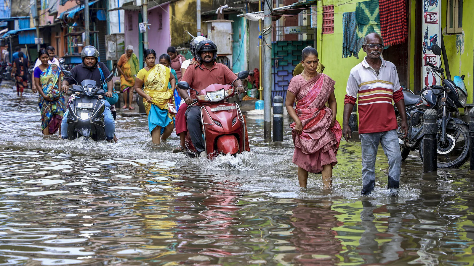
The latest IMD warning raises the risk of heavy rain in Tamil Nadu and Puducherry on Tuesday, November 10, with thunderstorms, lightning and squalls listed for the day. The department’s wider national outlook also flags unsettled weather across the Andaman and Nicobar Islands, parts of the Northeast and the western Himalayan region over the coming days. The warnings apply to specific regions and dates; they do not mean that every district will receive heavy rain or that all the listed areas face the same level of risk.
The sub-division warning page for Tamil Nadu and Puducherry, carrying a November 10 issue date, shows a heavy-rain warning alongside thunderstorm, lightning and squall hazards for the day. It lists no warning for the next four days, followed by heavy-rain warnings again on November 15 and 16. A separate national press release issued by the IMD on November 9 provides the broader outlook and the potential impacts for transport, farming and coastal activity.
Also read: IMD Declares Northeast Monsoon Onset, Warns of Heavy Rain in South India
The immediate concern is isolated heavy rainfall over Tamil Nadu, Puducherry and Karaikal. The national bulletin identifies November 9 and 10 as the main warning period for these areas, with another isolated heavy-rain possibility on November 15. The latest sub-division page for Tamil Nadu and Puducherry also lists thunderstorms, lightning and squalls on November 10, while showing no warning for November 11 to 14.
The warning is regional rather than uniform. Heavy rainfall under IMD terminology means 64.5 to 115.5 millimetres in 24 hours. Very heavy rainfall is 115.6 to 204.4 millimetres, while extremely heavy rainfall is more than 204.4 millimetres. A forecast of isolated heavy rain therefore points to the possibility of a high total at a limited number of locations, not continuous heavy rain across an entire state.
The department’s November 9 press release recorded heavy rainfall of 7 to 11 centimetres in Tamil Nadu during the preceding 24-hour observation period. Thoothukudi recorded 10 centimetres. That is a measured local total, not a statewide average, and it should not be read as a prediction that the same amount will fall across the state on November 10.
The IMD linked the weather pattern to an upper-air cyclonic circulation over the Comorin area and other atmospheric systems affecting the peninsula. These systems can concentrate rain over particular districts while nearby locations receive much less. The location and movement of rain-bearing clouds, local terrain and the condition of drainage systems all influence how a regional forecast translates into neighbourhood-level conditions.
For residents, the practical question is whether the district-level warning is current. The national and sub-division bulletins provide the broad risk picture, while local forecasts and district administrations can identify where a warning has been upgraded, extended or withdrawn. Schools, transport operators and local authorities should not infer a closure or service disruption from a rainfall forecast alone; such decisions require a separate notice from the responsible authority.
The Andaman and Nicobar Islands face one of the longer wet spells in the national outlook. The IMD forecast fairly widespread to widespread rainfall from November 9 to 15, with isolated heavy rainfall possible from November 10 to 14. Thunderstorms, lightning and gusty winds were also forecast during part of that period. The department’s advisory warned that the Bay of Bengal could become hazardous for small vessels near the south Myanmar coast, the adjoining east-central Bay and the Andaman Sea on November 10, with a further warning for the Andaman Sea from November 12 to 14.
In the Northeast, scattered rainfall is expected across Arunachal Pradesh, Assam and Meghalaya, as well as Nagaland, Manipur, Mizoram and Tripura, during the November 9 to 12 period. The bulletin identifies thunderstorms and lightning over Nagaland, Manipur, Mizoram and Tripura on November 10 and 11. Isolated heavy rainfall is forecast in those four states on November 11. These are separate warnings with different dates, not a single all-state alert.
The western Himalayan region is also expected to see a change as a fresh western disturbance approaches from the night of November 10. The IMD forecast isolated to scattered rain or snow over Jammu and Kashmir, Ladakh and adjoining areas on November 10 and 11, with further activity later in the week. Himachal Pradesh is expected to receive scattered rainfall at intervals from November 10 to 15. The more significant period for the Kashmir Valley is November 12 and 13, when isolated heavy rainfall or snowfall is possible.
The bulletin also warns of thunderstorms, lightning and gusty winds in parts of the western Himalayas during November 12 and 13. Wind speeds could reach 40 to 50 kilometres per hour, with gusts up to 60 kilometres per hour in the Jammu and Kashmir-Ladakh region. Himachal Pradesh could see winds of 30 to 40 kilometres per hour, gusting to 50, on those dates. These conditions can affect exposed roads, power lines and mountain travel, even when precipitation is not widespread.
By contrast, the IMD’s national release says no significant weather is expected over western and central India during the forecast week. Its Delhi-NCR outlook for November 10 points to partly cloudy skies and moderate fog in the morning, with maximum temperatures of 27 to 29 degrees Celsius and minimum temperatures of 14 to 16 degrees. That is a different pattern from the rain warnings affecting the south, islands and selected northern and northeastern areas.
Also read: Cyclone Murasu Intensifies Into Severe Storm; IMD Warns of 120 km/h Winds
The IMD’s impact assessment identifies several possible consequences of heavy rain and squally weather: broken branches, uprooted small trees, damage to plantations and standing crops, and partial damage to vulnerable structures. Waterlogging or localised flooding may affect low-lying areas, while heavy rain can reduce visibility and disrupt road and rail traffic. These are forecast risks, not reports that such damage has already occurred in every warned location.
Farmers in Tamil Nadu have been advised to use clear intervals to harvest mature paddy and groundnut and move harvested produce to dry storage. In the Cauvery Delta, the bulletin recommends maintaining drainage in rice fields and removing excess water to prevent stagnation. It also advises farmers to store harvested banana bunches in dry places, ensure drainage in coconut fields and postpone irrigation, fertiliser application and spraying during rainfall.
The advisory for the Andaman and Nicobar Islands similarly emphasises drainage in crop fields and delaying field operations during wet spells. In areas where strong winds are forecast, harvested produce should be secured or covered, and vulnerable horticultural plants should be supported. Livestock owners are advised to keep animals under shelter and protect feed from rain. Fisheries operators are asked to manage pond outlets carefully so that overflowing water does not carry stock away.
For the public, the department’s safety advice is straightforward. People should avoid standing under trees during thunderstorms, move away from water bodies when lightning is expected and keep clear of objects that conduct electricity. Electrical and electronic appliances should be unplugged where lightning is imminent. Residents in low-lying locations should monitor local warnings and be prepared to move if authorities issue evacuation instructions.
Fishermen and small-boat operators should pay particular attention to the Bay of Bengal and Andaman Sea advisories. The national bulletin lists no warning for the Arabian Sea, but the absence of a warning in one sea area does not replace routine checks of local marine conditions. Operators should use the latest marine bulletin rather than relying on a forecast issued several days earlier.
The next updates will determine whether the November 10 warning for Tamil Nadu and Puducherry is followed by a new district-level alert, and whether the separate warnings for the Andaman Islands, Northeast and western Himalayas change as the weather systems develop. The current sub-division page shows no warning for Tamil Nadu and Puducherry from November 11 to 14, but it again lists heavy rain on November 15 and 16. That forecast can change, so the dates should be treated as the position at the time of the bulletin rather than a guarantee of dry weather between warning periods.
The distinction between a broad forecast and a district warning matters most when people make decisions about travel, harvesting, fishing or school attendance. A regional alert signals that conditions may become hazardous in parts of the area; it does not establish that every town will be affected in the same way. The safest course is to follow the latest IMD district warning and any specific direction issued by local authorities.




Comments (0)
Be the first to comment. Comments are published after moderation.