


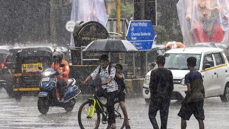
NEW DELHI, November 10, 2026 — A fresh western disturbance is likely to affect the northwestern Himalayan region from the night of November 10, bringing a spell of rain and snow to parts of Jammu and Kashmir, Ladakh and Himachal Pradesh, according to the India Meteorological Department’s all-India forecast bulletin issued on November 9. The department expects fairly widespread to widespread precipitation over Jammu and Kashmir and Ladakh on November 12 and 13, with isolated heavy rainfall possible during those two days. The same bulletin forecasts dry conditions for Delhi, Haryana and Chandigarh through its seven-day outlook, underlining that the system’s effects will not be uniform across northern India.
The forecast matters for mountain districts preparing for a change in weather after a largely dry spell, for farmers and horticultural growers working around harvest and orchard schedules, and for people planning road journeys through high-altitude routes. Rainfall at lower elevations and snowfall at higher elevations can affect visibility, road surfaces, local transport and access to remote settlements. The IMD has also warned of thunderstorms, lightning and gusty winds in parts of the western Himalayan region, so the risk is not limited to precipitation.
The November 9 bulletin, issued at 1:33 pm IST, says the western disturbance is likely to affect the northwestern Himalayan region from the night of November 10. For Jammu and Kashmir, Ladakh and adjoining areas, the department forecasts isolated to scattered rainfall on November 10 and 11, followed by fairly widespread to widespread rainfall on November 12 and 13. Another spell of isolated to scattered precipitation is possible on November 14 and 15. The bulletin separately identifies isolated heavy rainfall over Jammu and Kashmir and Ladakh on November 12 and 13. In higher reaches, the precipitation may fall as snow, although the exact snow line will depend on local temperature and elevation.
Himachal Pradesh is forecast to receive isolated to scattered rainfall between November 10 and 15. The seven-day table indicates scattered precipitation in parts of the state on November 12 and 13, with isolated activity on surrounding days. The IMD expects gusty winds of 30–40 kmph, gusting to 50 kmph, at isolated places in Himachal Pradesh on November 12 and 13. These conditions can affect exposed roads, temporary structures, orchard work and travel in districts where rain or snow coincides with strong winds.
Uttarakhand has a narrower forecast window in the November 9 bulletin: isolated to scattered rainfall is likely on November 12 and 13. The department does not forecast a continuous statewide rain event. Local conditions may differ between the higher Himalayan districts, the middle hills and the plains, so residents should use the district forecast rather than assume that the entire state will receive the same amount of rain.
Punjab may see isolated rainfall from November 12 to 15. The IMD’s seven-day table, however, marks Haryana, Chandigarh and Delhi as dry for the forecast period from November 9 to 15. This distinction is important because some secondary reports have grouped the plains with the Himalayan states. The official table does not support a blanket claim that Delhi will receive rain from this western disturbance. Forecasts can be revised, but the bulletin available on November 10 gives the capital a dry outlook.
Also read: Delhi Air Pollution: City Tops IQAir Ranking Ahead of Diwali
The bulletin does not specify a uniform snow depth or guarantee snowfall in every hill station. Precipitation type depends on elevation, the freezing level, the temperature profile and the timing of the system. A valley town may receive rain while a higher pass sees snow, and a cold night after rainfall can create icy patches even where snowfall is absent. The distinction matters for travellers: a forecast of rain or snow for a meteorological subdivision does not mean every route will experience the same conditions.
A western disturbance is an eastward-moving weather system embedded in the mid-latitude westerly flow. It can carry moisture from regions west of India towards the western Himalayas and adjoining northern areas. When the system interacts with the mountain terrain, air is forced to rise, cool and condense. The resulting precipitation can fall as rain in warmer valleys and as snow at higher elevations. The height of the freezing level, the strength and track of the system, and the amount of moisture available all influence where snow falls and how much precipitation is recorded.
The term does not mean that every district in northern India will receive rain. A western disturbance may bring widespread precipitation to one part of the Himalayas while leaving nearby plains dry. The IMD’s forecast tables divide the country into meteorological subdivisions and use categories such as isolated, scattered, fairly widespread and widespread. In the bulletin, isolated precipitation refers to activity at a small share of stations, while widespread precipitation covers a much larger share. These categories describe distribution, not a promise that every village or town will receive rain.
The November 9 bulletin records that a fresh disturbance is expected to affect the northwestern Himalayan region from the night of November 10. It also notes other atmospheric features, including upper-air cyclonic circulations and a trough. Such systems can influence local rainfall and thunderstorms, but the forecast should be read as a combination of several weather features rather than as a single storm crossing the whole country.
Heavy rain or snow in the mountains can create localised hazards even when the forecast is limited to isolated areas. Roads may become slippery, water can collect on low-lying stretches, and steep slopes can become unstable after sustained or intense precipitation. The IMD’s impact advisory warns of possible localised landslides, mudslides, waterlogging and inundation in vulnerable locations. It also says that road and rail traffic, helicopter services and tourism or recreational activity may be affected. These are potential impacts, not a statement that every route will be closed.
People travelling through Jammu and Kashmir, Ladakh, Himachal Pradesh or Uttarakhand should check the latest district forecast and local administration advisories before departure. A route that is open in the morning may be affected later if rain, snow, fallen branches or poor visibility develops. Drivers should avoid stopping beneath trees during thunderstorms, allow additional time on mountain roads and follow instructions from traffic police and road authorities. Travellers should not rely only on a national headline when planning a journey between two specific towns.
Farmers and orchard owners should use the local agricultural advisory as well as the general weather forecast. The IMD’s November 9 bulletin advises farmers in affected regions to protect harvested produce from rain and wind, secure stored crops and postpone operations such as irrigation, fertiliser application and spraying during rainfall. Horticultural plants may need support where gusty winds are forecast. The precise action depends on crop stage, soil condition and the local forecast, so blanket advice cannot replace district-level agricultural guidance.
Residents should take lightning warnings seriously. During a thunderstorm, people should move to a substantial building or enclosed vehicle, stay away from open fields and water bodies, and avoid sheltering beneath isolated trees. Electrical appliances should be unplugged when lightning is expected and it is safe to do so. Loose outdoor objects should be secured before strong winds arrive. People in areas prone to slope failure should watch for fresh cracks, unusual water flow or small slips and follow evacuation instructions from local authorities.
For high-altitude communities, snowfall can be both beneficial and disruptive. Snow replenishes seasonal water stores and can support winter tourism, but a sudden spell may affect road access, power lines and supplies. The effects depend on snow depth, wind, temperature and whether precipitation falls on already frozen ground. It is therefore premature to infer a severe winter from one forecast episode. The bulletin describes a specific weather system and a seven-day window, not the full seasonal outlook.
The next important update is the IMD’s daily forecast and subdivision- or district-level warning for November 11–13. The department’s forecast validity runs from 8:30 am IST on one day to 8:30 am the next day, so the date shown on a warning should be read with that period in mind. The Srinagar Meteorological Centre’s November 10 warning page lists heavy rain, thunderstorms and lightning for Jammu and Kashmir on November 12 and 13, while showing no warning for November 10 and 11. That is a more precise guide for the region than a broad national description.
Forecasts are updated as observations and model guidance change. A shift in the system’s track or speed can alter the timing and distribution of precipitation, and mountain weather can vary over short distances. Residents should check the latest IMD bulletin, local district advisories and road-status announcements before making decisions. The current outlook points to the strongest western Himalayan precipitation on November 12 and 13, while Delhi and the adjoining plains are forecast to remain dry in the seven-day table available on November 10.



Comments (0)
Be the first to comment. Comments are published after moderation.